Why Lofoten Should be on Your Travel Bucketlist
/
To be honest, I had never heard of Lofoten until 2 years ago. It wasn’t until photographs of its iconic scenery started showing up on my social media feed that I became enthralled with this region.
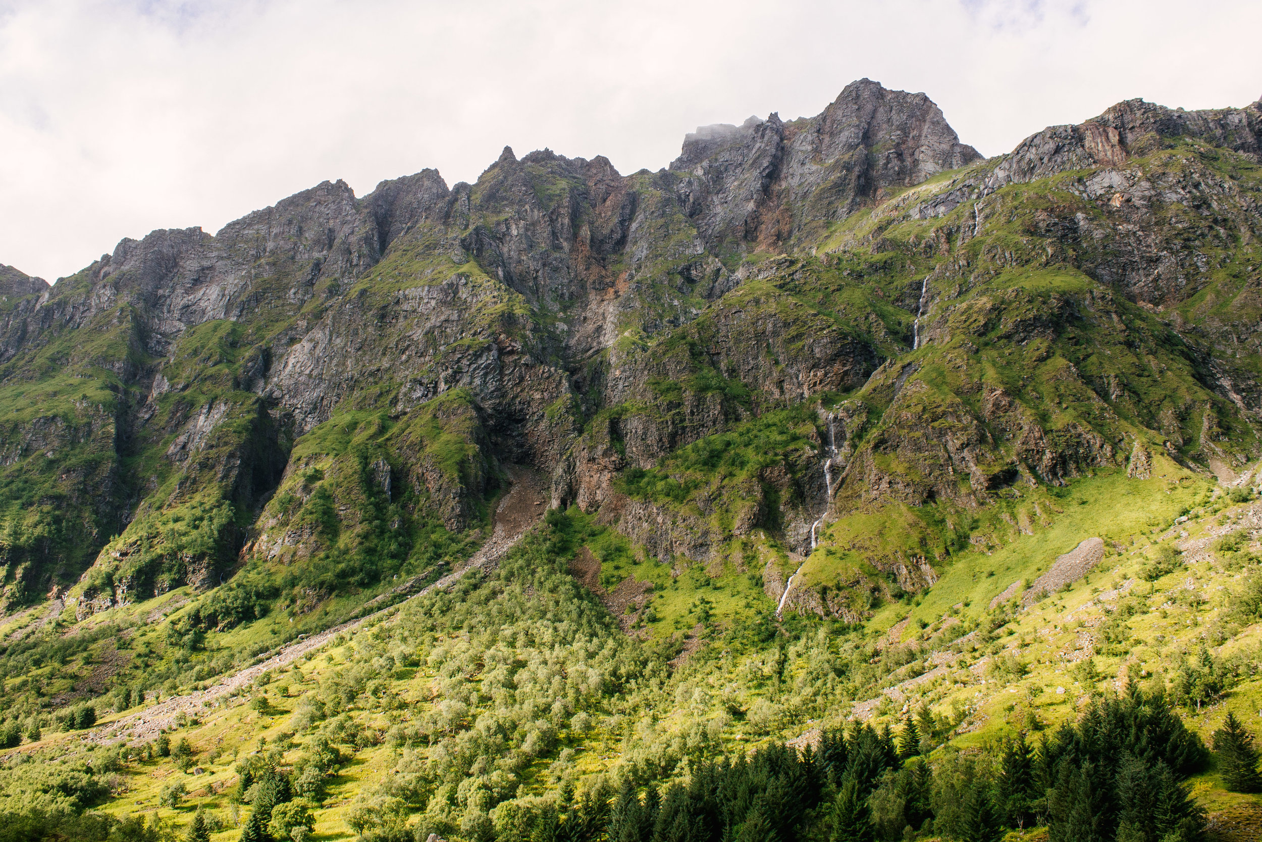
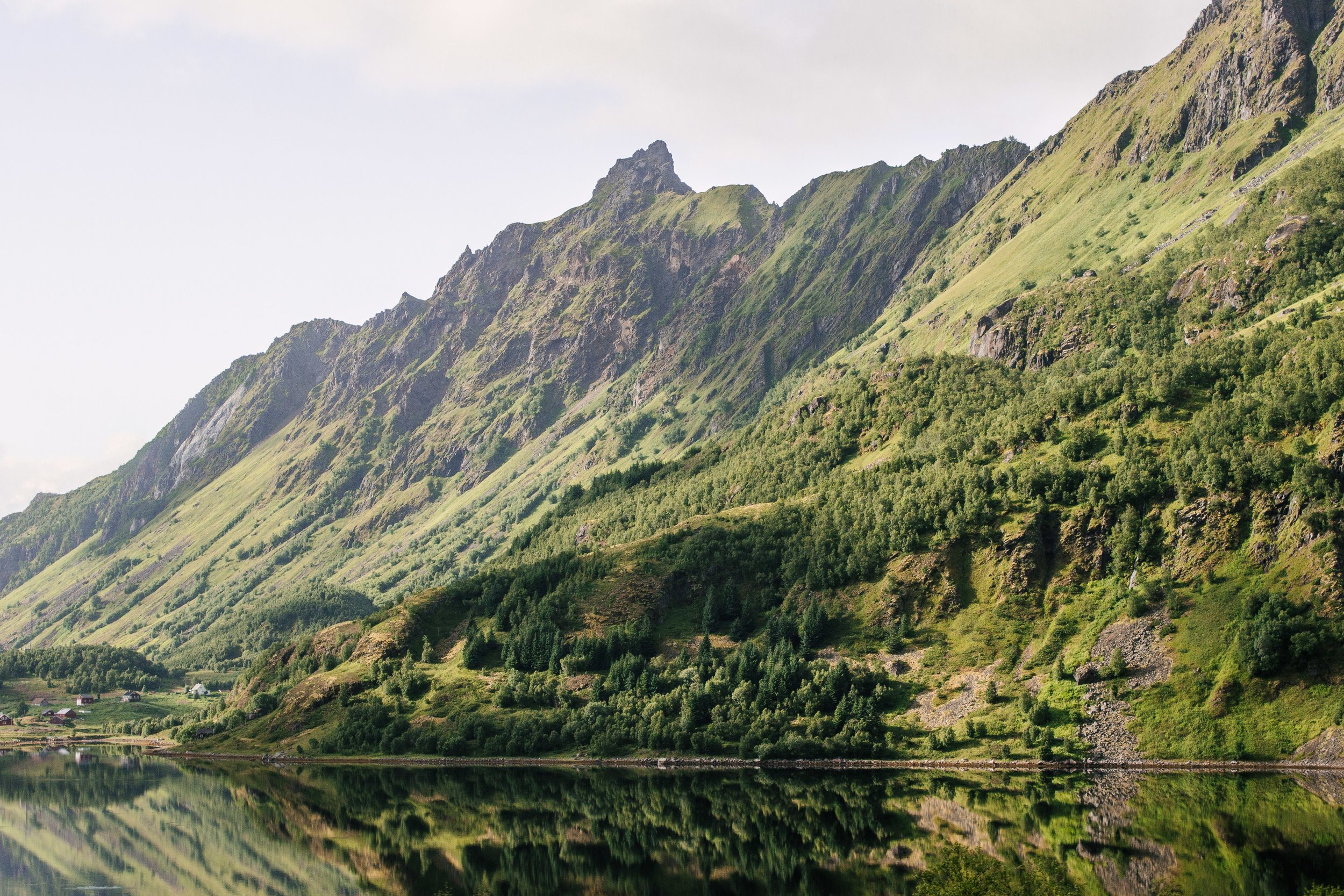
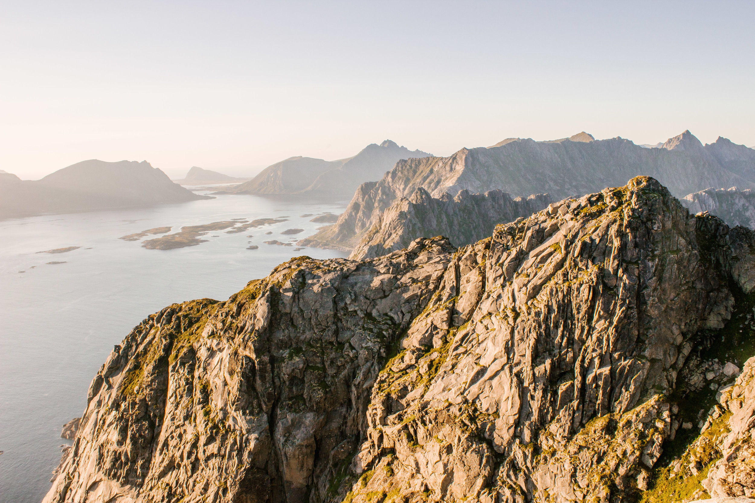
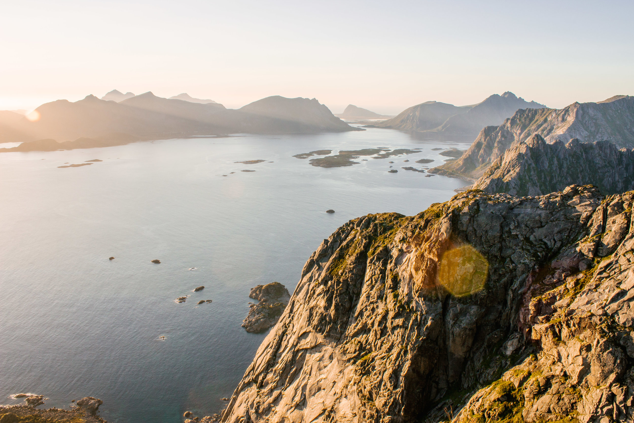
Lofoten is located off northern Norway, just within the Artic Circle. It is comprised of a granite archipelago (read: giant, pointy granite towers shooting out of the ocean). It’s pristine, untouched beauty makes it a photographer’s dream. But thanks to such photography captures, tourism in Lofoten has exploded in the last few years – faster than the narrow roads can keep up with. However, while we were there I didn’t feel like the region was overrun by tourism, though some of the footpaths of the more popular hikes are starting to erode.
To fully experience Lofoten, we decided to road trip between the main islands. Along the way we saw inland farming towns, charming fishing villages, and countless stunning views.
Below I have outlined some of our favorite things we did while in Lofoten to help show you why Lofoten should be on YOUR bucketlist!
Roadtripping
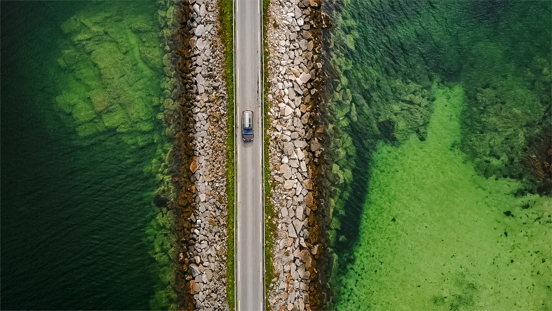
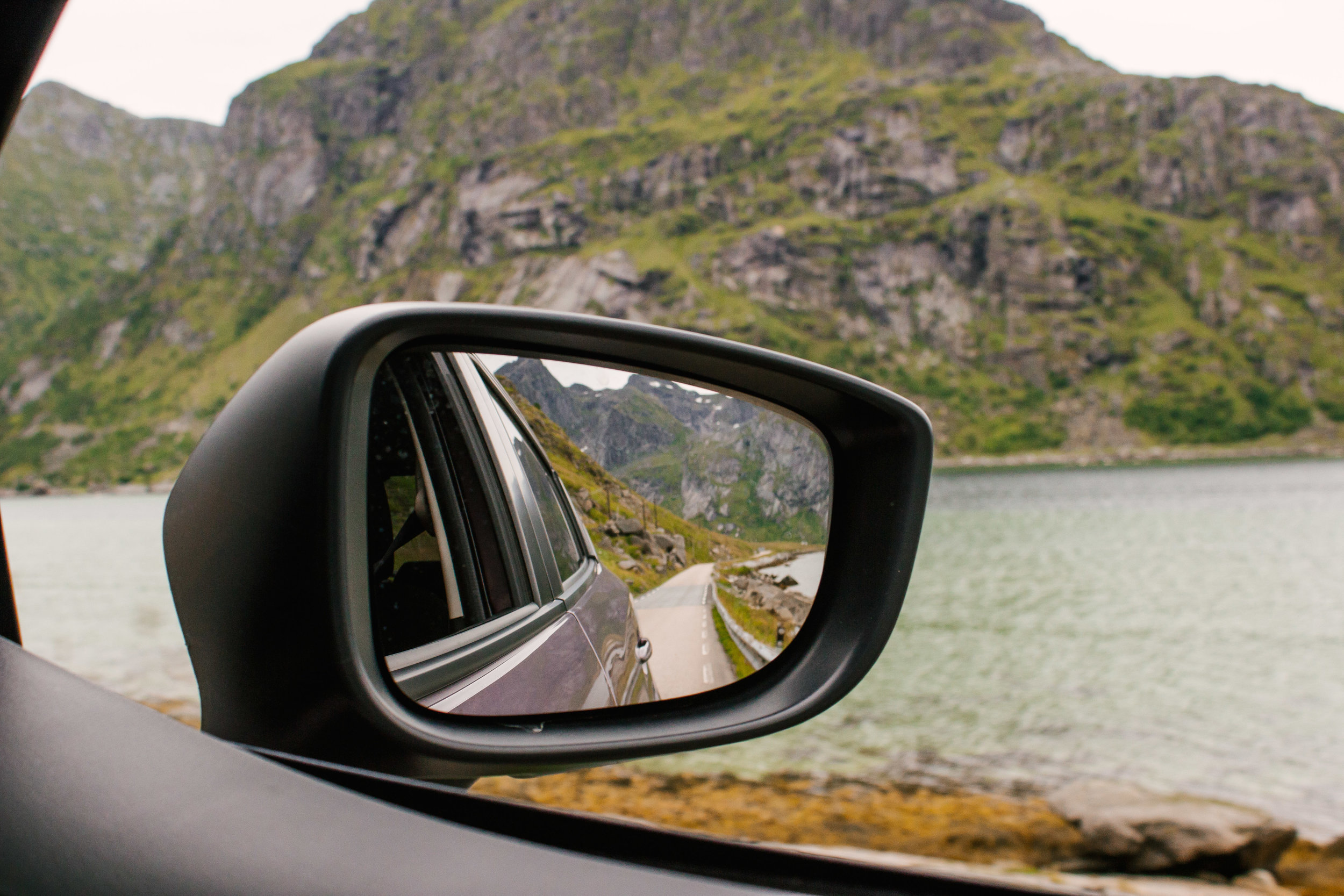
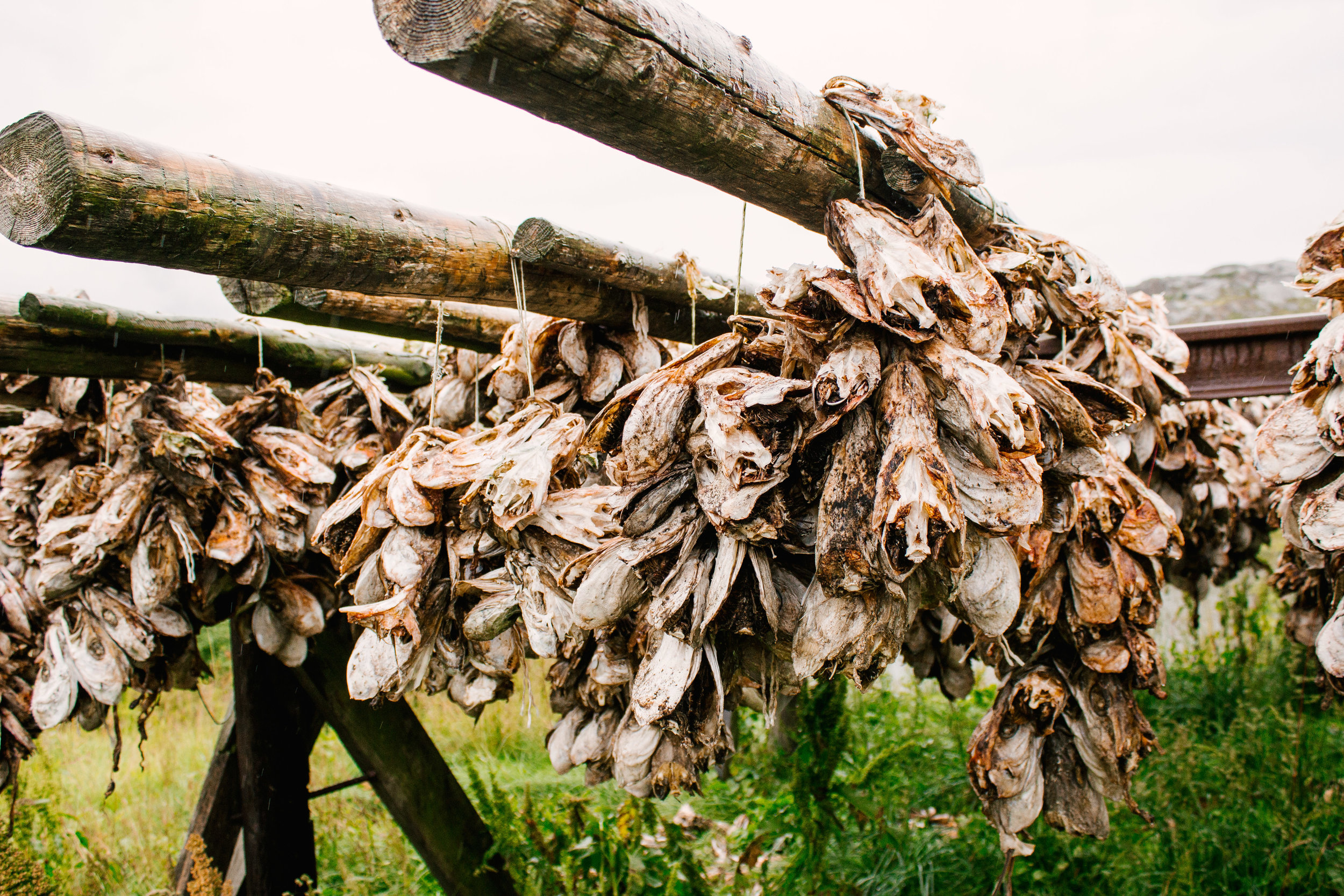
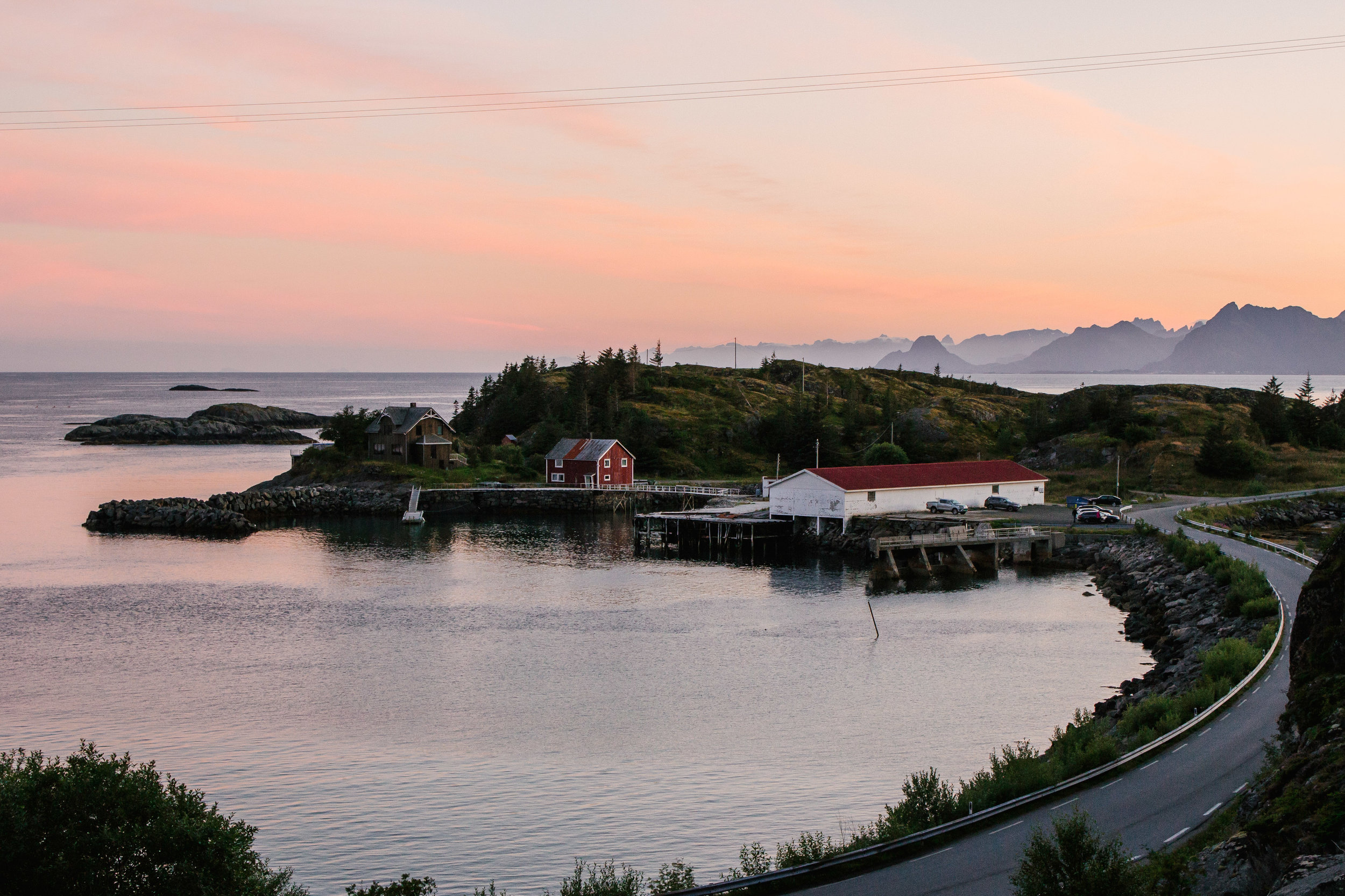
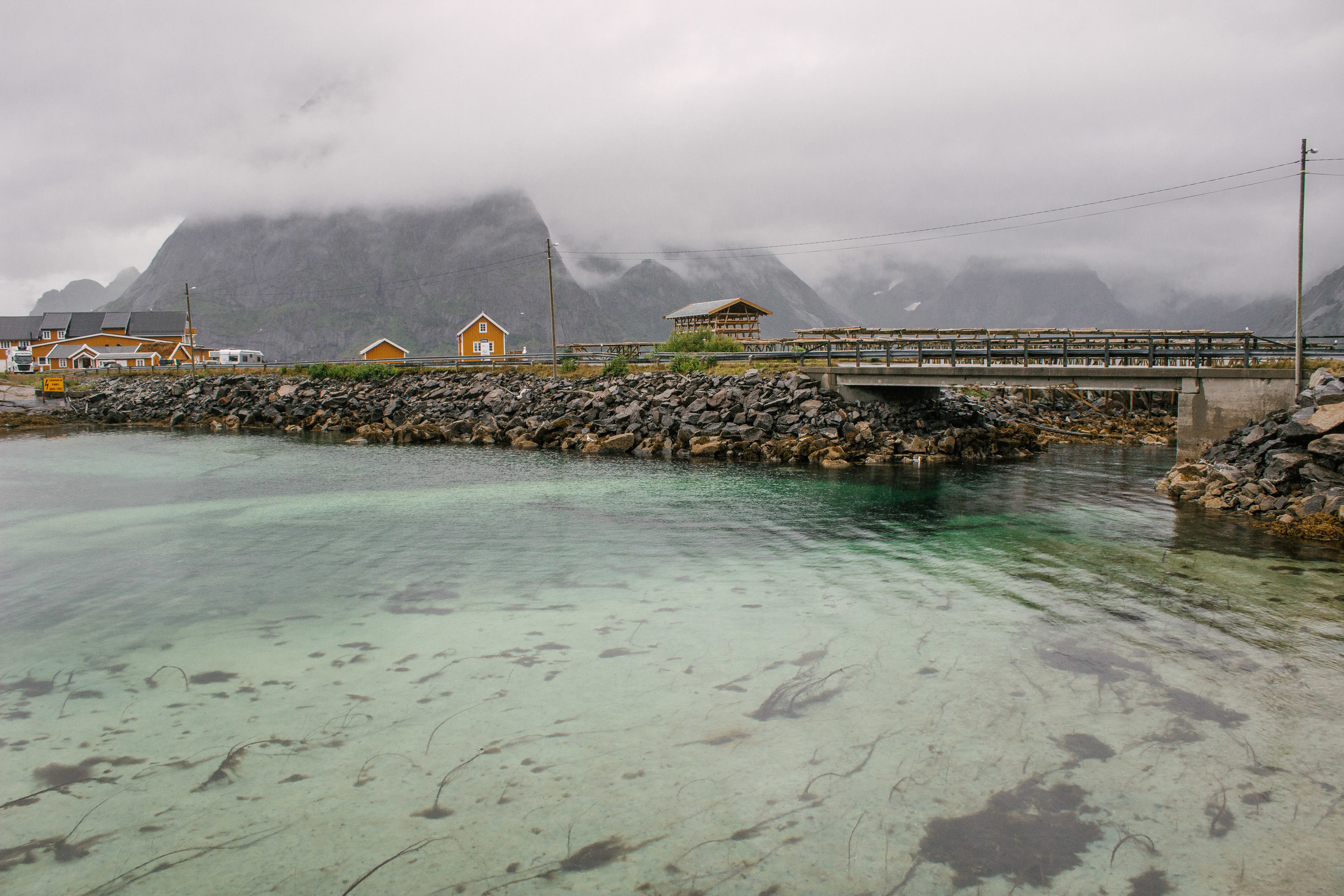
If I could give only one reason as to why Lofoten should be on your bucketlist it would be driving the scenic main road (the E10). We opted to drive from the mainland to Lofoten rather than take the 4 hour ferry across the Norwegian Sea. This allowed maximum driving time amongst some of the most beautiful landscapes I have ever seen. The entire time I was screaming in amazement at how BEAUTIFUL everything was outside of our windows. Depending on the time of year you travel to Lofoten, you may drive past thousands upon thousands of drying cod. We weren't so lucky to see this sight (though we did manage to find one rack of drying cod), but we did see the countless number of drying racks throughout the islands.
Festvågtind
This hike was one of the highlights during our time in Lofoten. Located near the town of Henningsvaær, this hike is a steep upward climb, taking about 3 hours round trip. The start of the hike is difficult to find – during the summer, the surrounding bushes created a slight archway over the trailhead, but you only really notice it when you are standing directly in front of it! There are 2 small parking lots along the road nearby, but most people had to park farther away.
Once you start at the trailhead the trail will put you in a large boulder field. There are some spray-painted “T”s to mark the path, but just keep heading towards the center of the hill. Once crossing the boulders, you will see the trail ahead of you more easily. From the road, this portion of the trail simply looked like people scrambling over rocks, with no clear path. However, at closer look, the trail is well marked parallel to the portion of the mountain face covered in large rocks. As you make your way up, you will begin to see a small lake below to your right. The trail will then start to wrap around the backside of the mountain until you reach the peak.
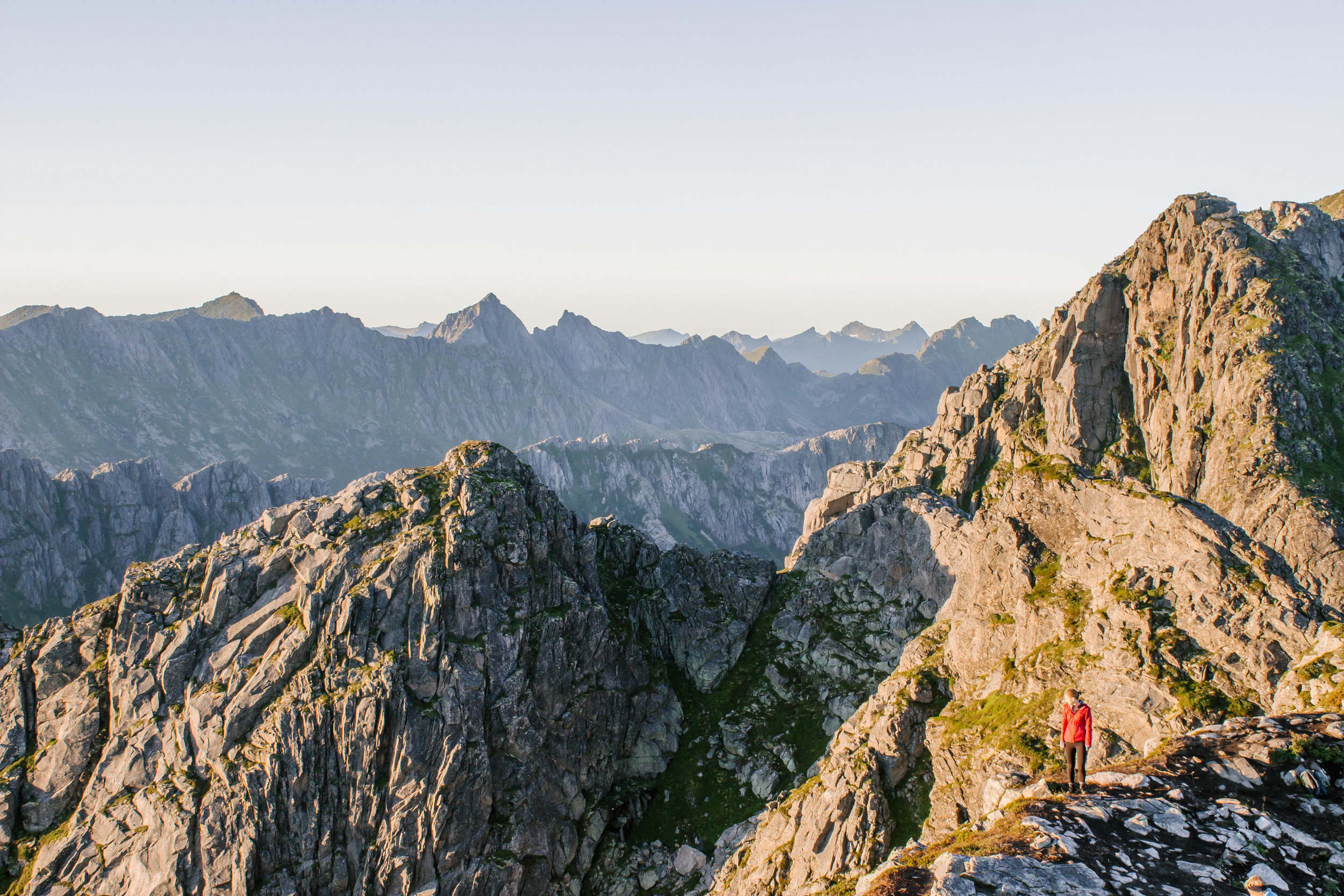
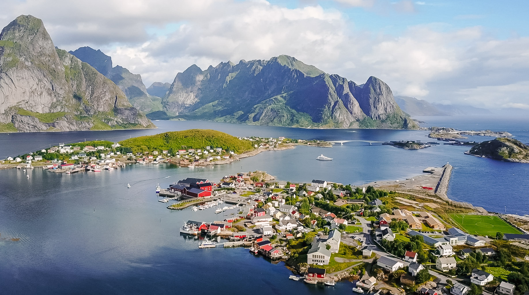
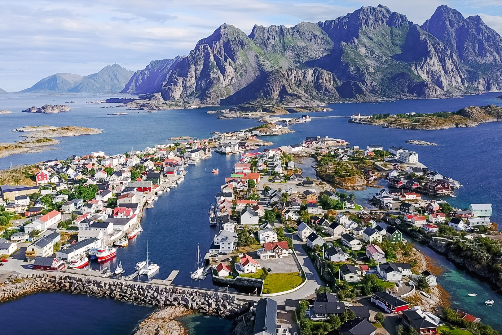
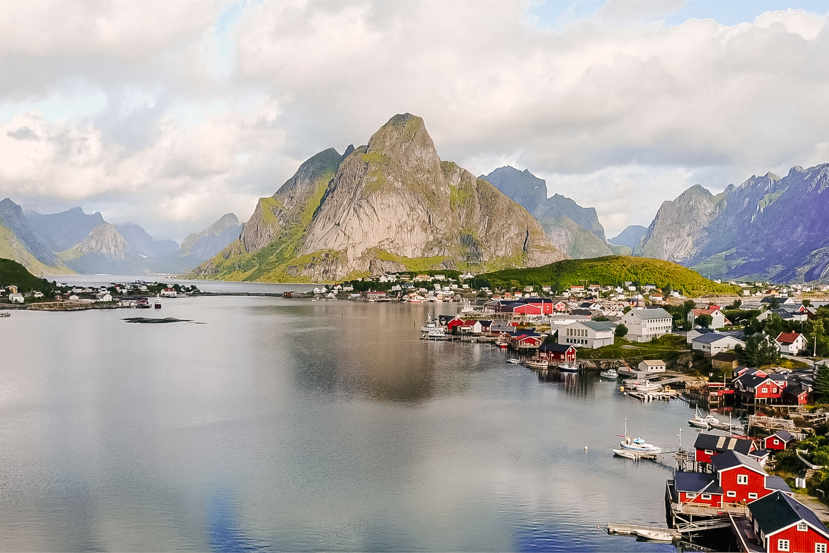
One of my favorite things about this hike were the views throughout the entire time. The view of the town of Henningsvaær, a cluster of tiny islands connected by bridges, will be unlike anything you have ever seen before. When we finally reached the top the sun’s rays warmed our faces as we emerged from the cool breezed backside of the mountain. The sun was slowly setting at this point, creating a pastel masterpiece in the sky against the mountain peaks. In the distance we could see two fellow hikers exploring a neighboring mountain – their tiny siloutte’s highlighting the grandiosity of the granite monsters. The views alone from this hike are reason enough to make a trip to Lofoten!

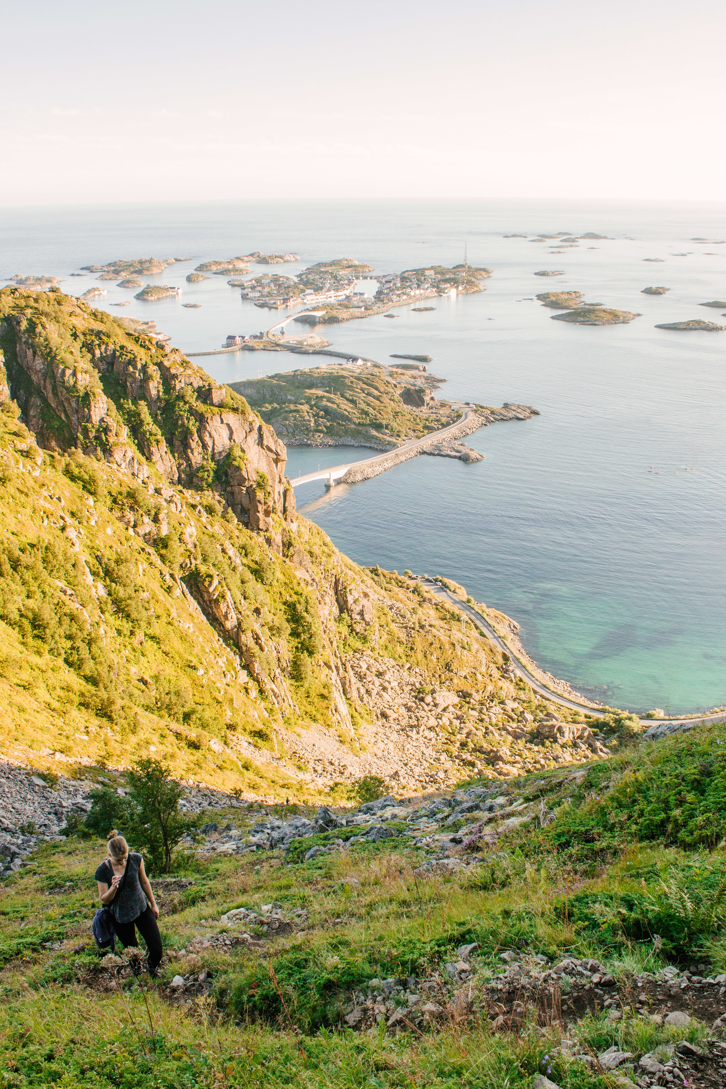
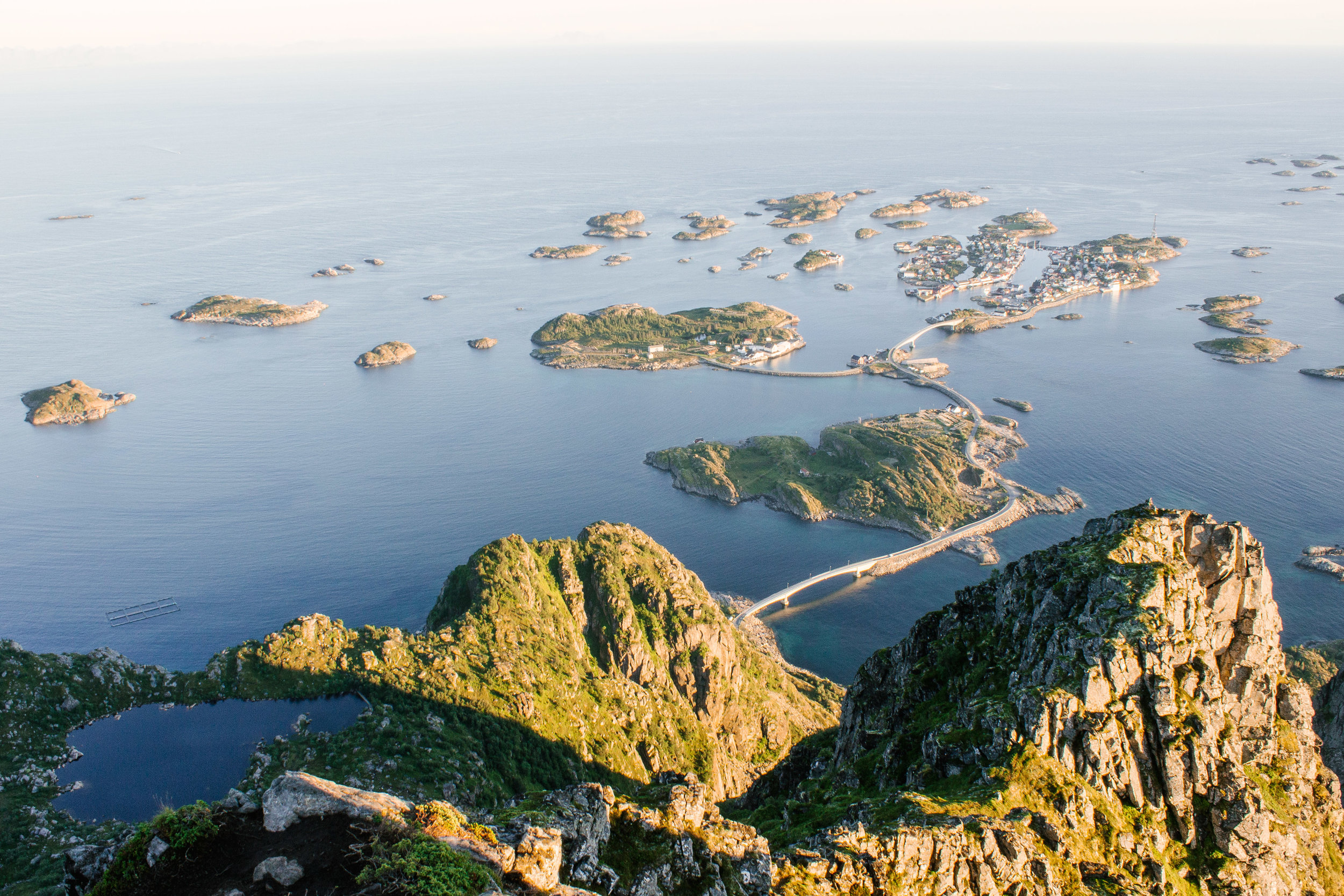
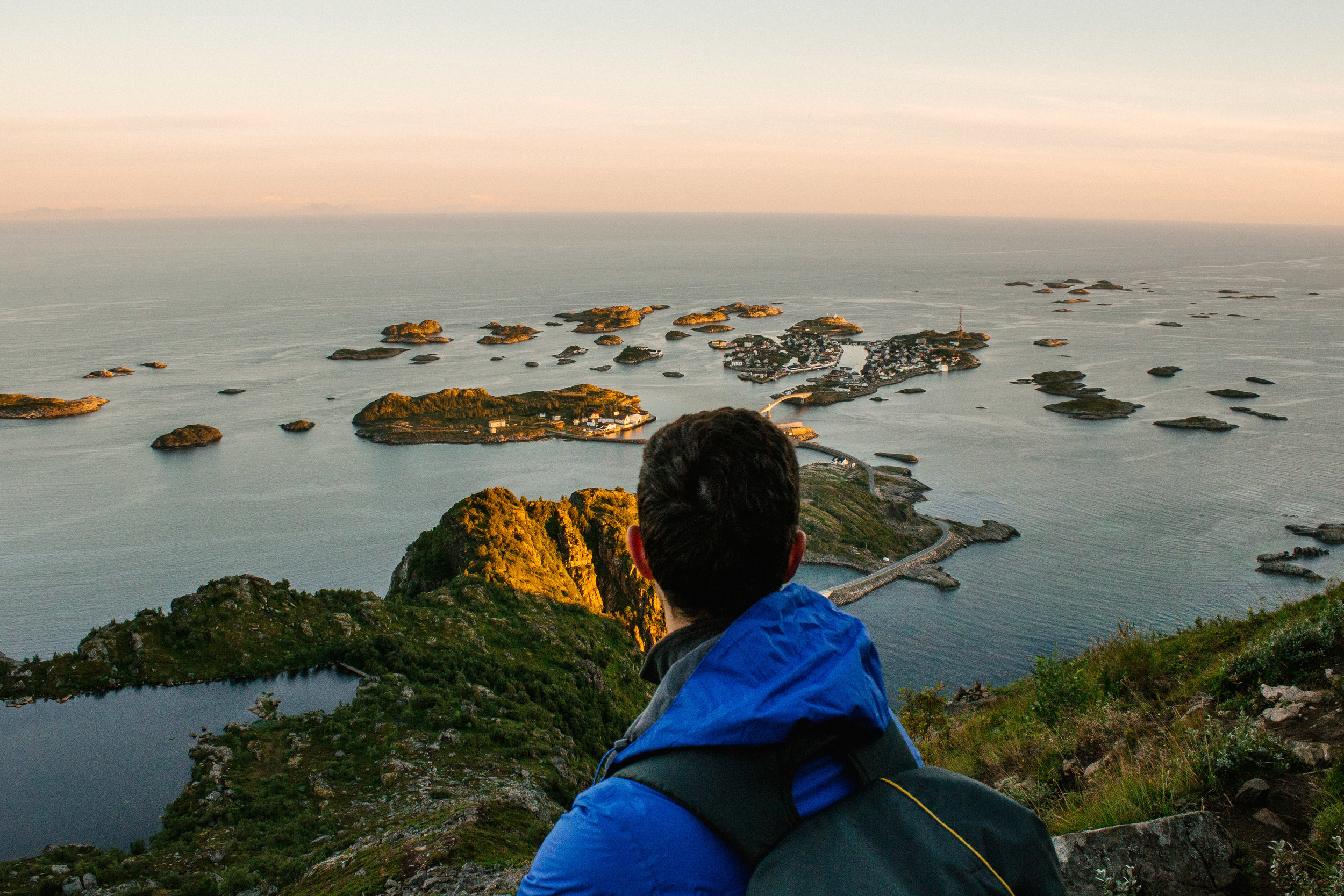
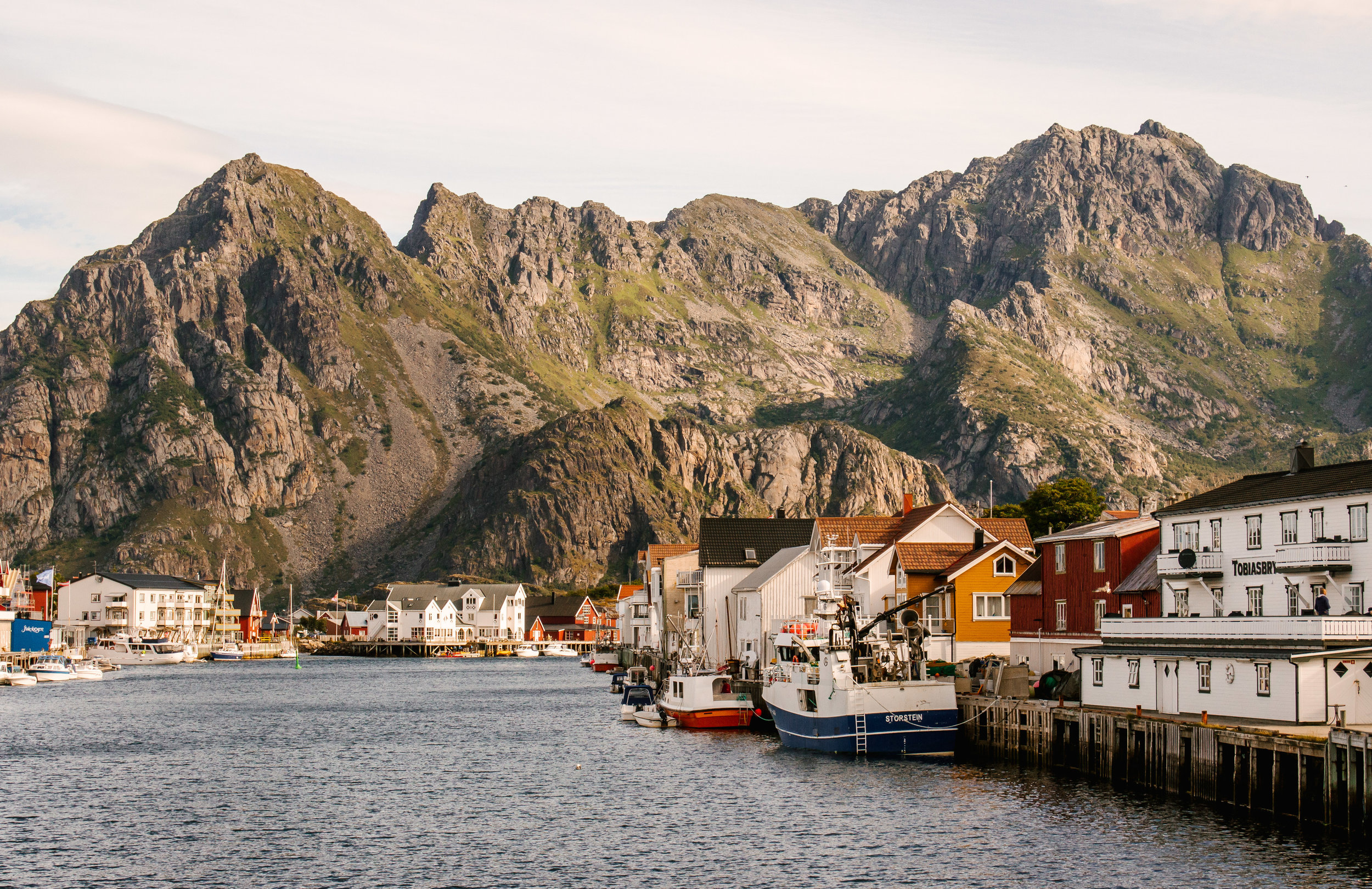
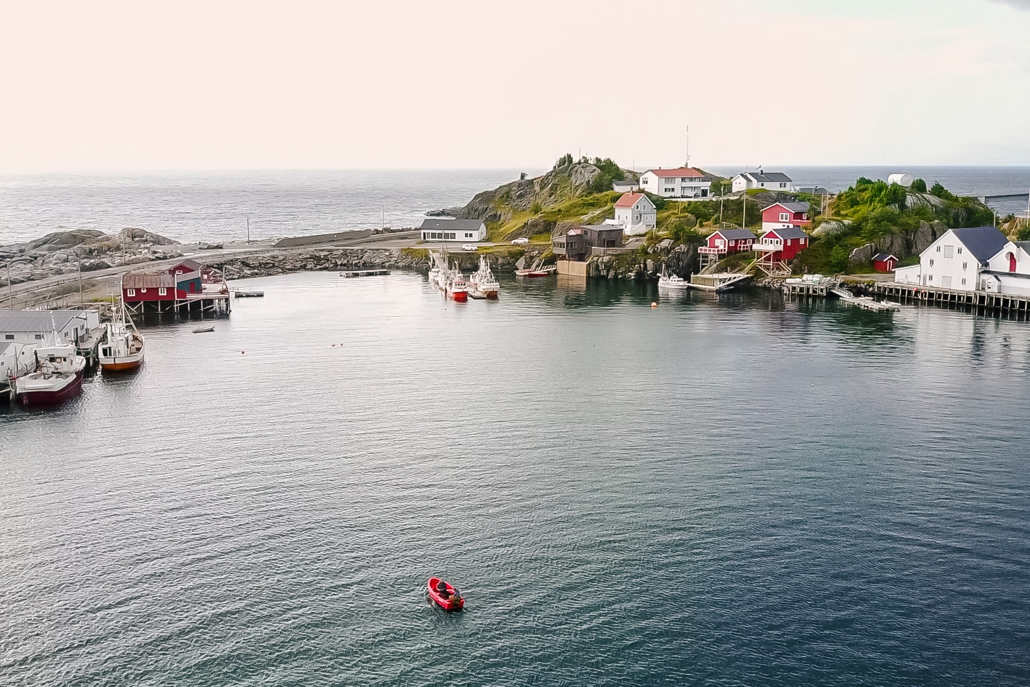
Henningsvaær
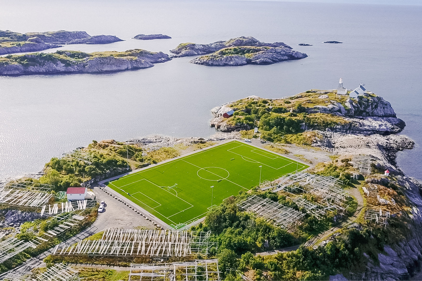
Once you’ve completed Festvågtind, explore the beautifully unique town of Henningsvaær. Like I’ve mentioned before, this town is comprised of a tiny cluster of islands, the larger of which are connected to one another via bridges. The village is filled with colorful houses, art boutiques, cafes, and a beautiful fishing port. Oh, and there’s a soccer field.
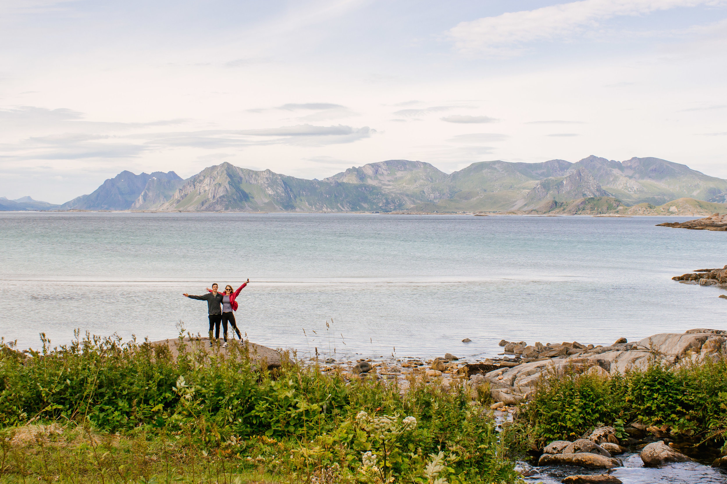
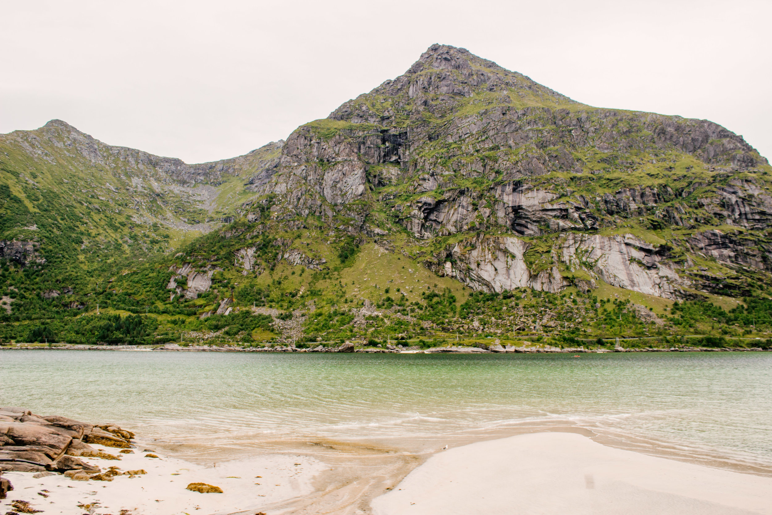
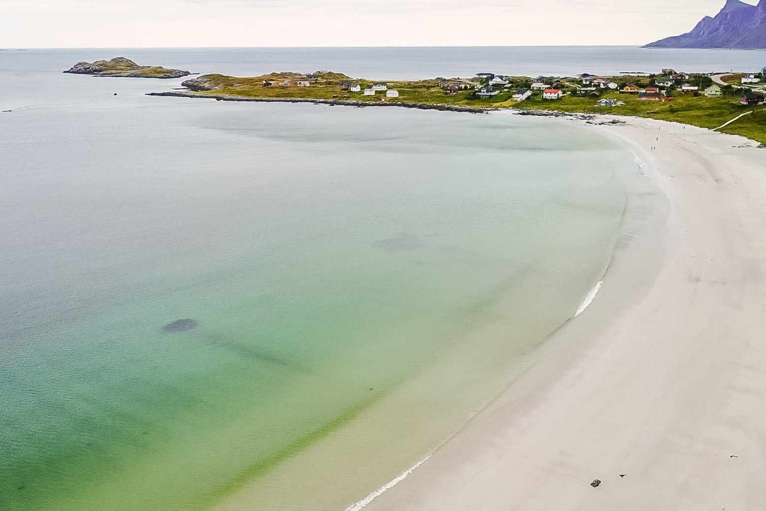
Ramberg Stranda
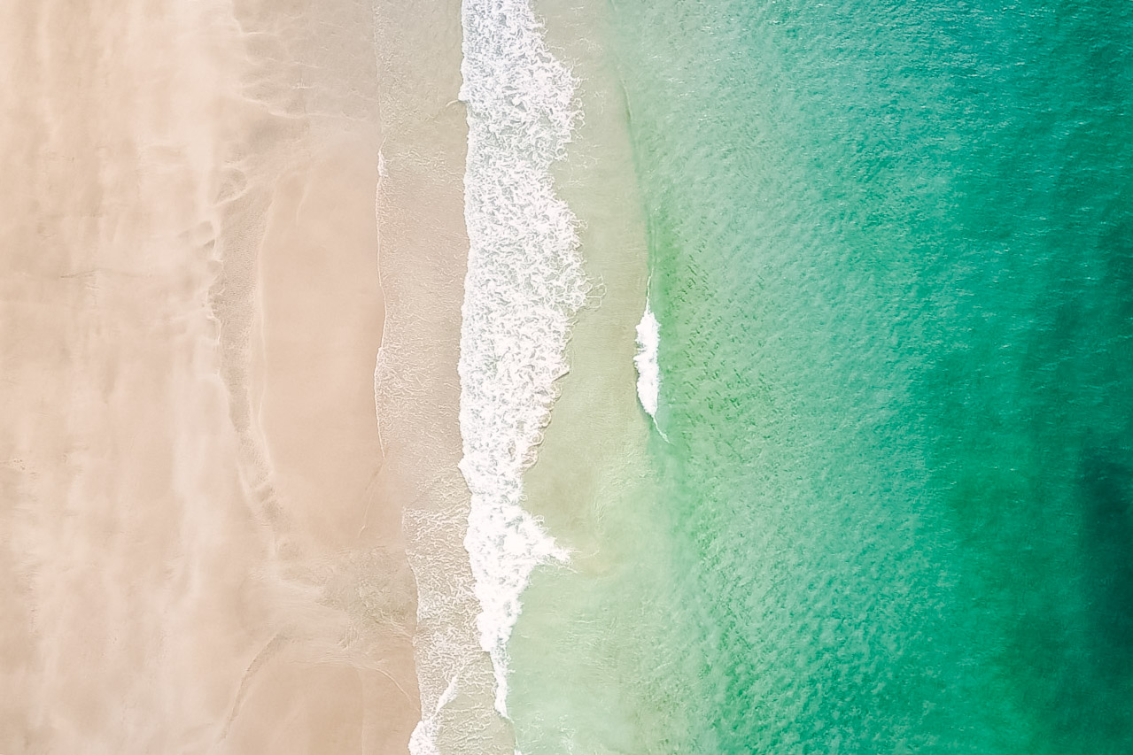
A large stretch of white sand beach and turquoise ocean waters – what could be better? When you have it all to yourself, that’s what! While Lofoten has been gaining more recognition over the years as a travel destination, it still does not feel crowded. This was especially obvious when we had such a beautiful beach all to ourselves. The fact that it was slowly starting to rain may have had a tiny hand in that as well ;).
For the backpacking folks: There is a campsite next to the beach that has both trailer and tent camping. The restaurant/camp reception has free wifi, which was useful when checking the ever changing Lofoten weather.
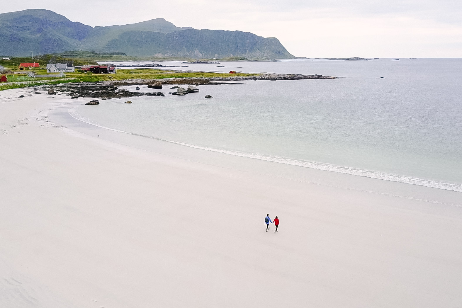
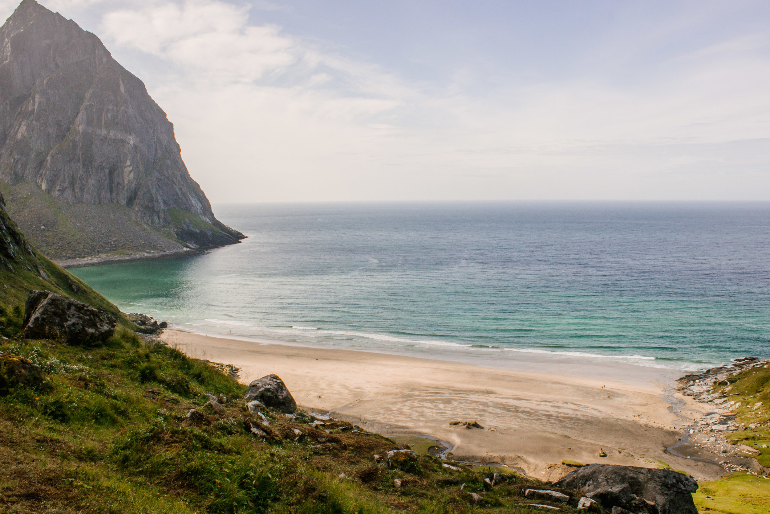
Kvalvika Beach
Near Reine, there are a few beaches that are only accessible via hiking. Some of these beaches included: Horseid, Bunes, and Kvalvika. We only were able to make it to the latter of the three. The hike out is easy, taking about 1-2 hours. The trail can be very muddy if there was recent rainfall. However there are wooden planks to help you navigate through the muddy terrain. Eventually you reach the top of a hill and see the beach. Pristine, white sand beach, and turquoise water – I was in disbelieve that we were looking out onto the Artic Ocean.
To get an even better view of the isolated beach, hike up Ryten Mountain. If we had had more time, I would have loved to done this hike! The hike takes 2-3 hours to complete, with an elevation gain of 540 meters. When facing the ocean from Kvalvika Beach there will be a small stream coming off the mountain to the right. Next to this stream will be a trail that you can use to ascend the mountain.
For the backpacking folks: Camping at Kvalvika Beach is a great option for you! The flat, grassy dunes at the back of the beach provides numerous spots to pitch a tent.
TIPS: There is limited parking near the trailhead, so given the popularity of this hike you will likely find yourself having to park far away (we found parking half a mile away).
Reinebringen
While we weren’t able to do this hike ourselves, it is Lofoten’s most popular hike. It provides an iconic panoramic view from the summit, looking down on the fishing village of Reine below.
It is a 2 hour “hike”. I’m calling it a hike, but really it is a climb, with a 1400 foot elevation gain just over half a mile. The current trail is too dangerous to use due to deterioration and erosion from excessive numbers of people walking on it, causing rock fall to become a more common occurrence. The trail is extremely steep, and slippery – with some portions of the trail requiring ropes. With that it mind, it is highly advised that you do not hike if it recently rained or is forecasted to rain. Additionally, do not attempt to hike without proper hiking boots!
Due to the hike’s popularity, the Norweigan Environment Agency began building a new trail in early 2016, with expected completion time in the summer of 2018. Until that time the trail is not blocked off thanks to Norway’s "free to roam" policy, rather is it just recommended not to do this hike until the new path is done.

Picture from https://norwaytravelguide.no/connect-with-locals/Carina/info-about-hiking-reinebringen
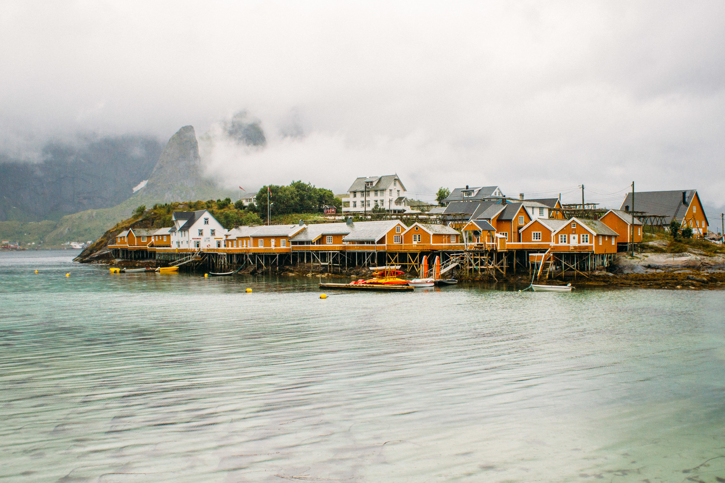
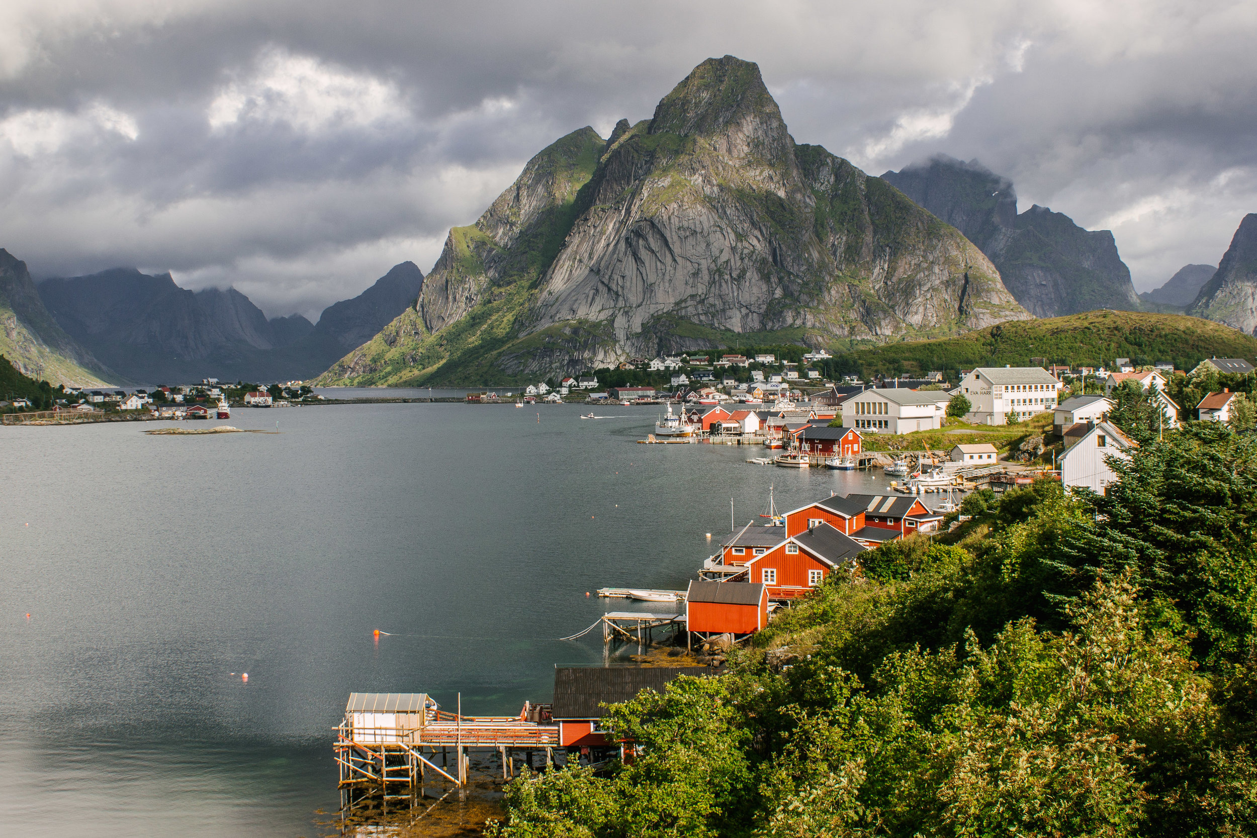
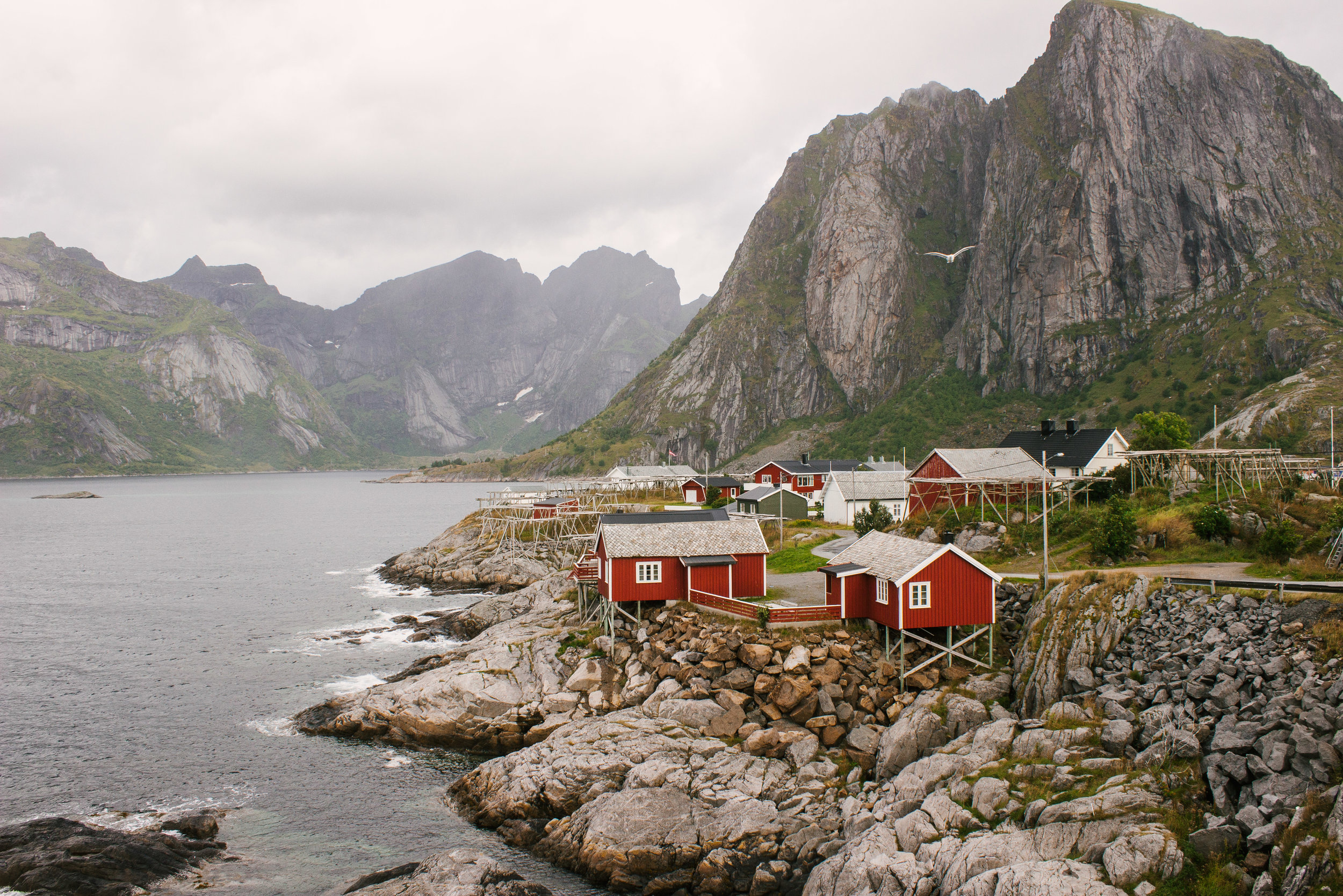
Reine
Reine is the most picturesque fishing village that you will ever see! Seriously, it was voted one of the most scenic villages in the world by National Geographic! It is one of the few villages in Lofoten that still has a thriving fishing community. Up the road from Reine is also some INCREDIBLE photo spots: Hamnøy and Sakrisøya.
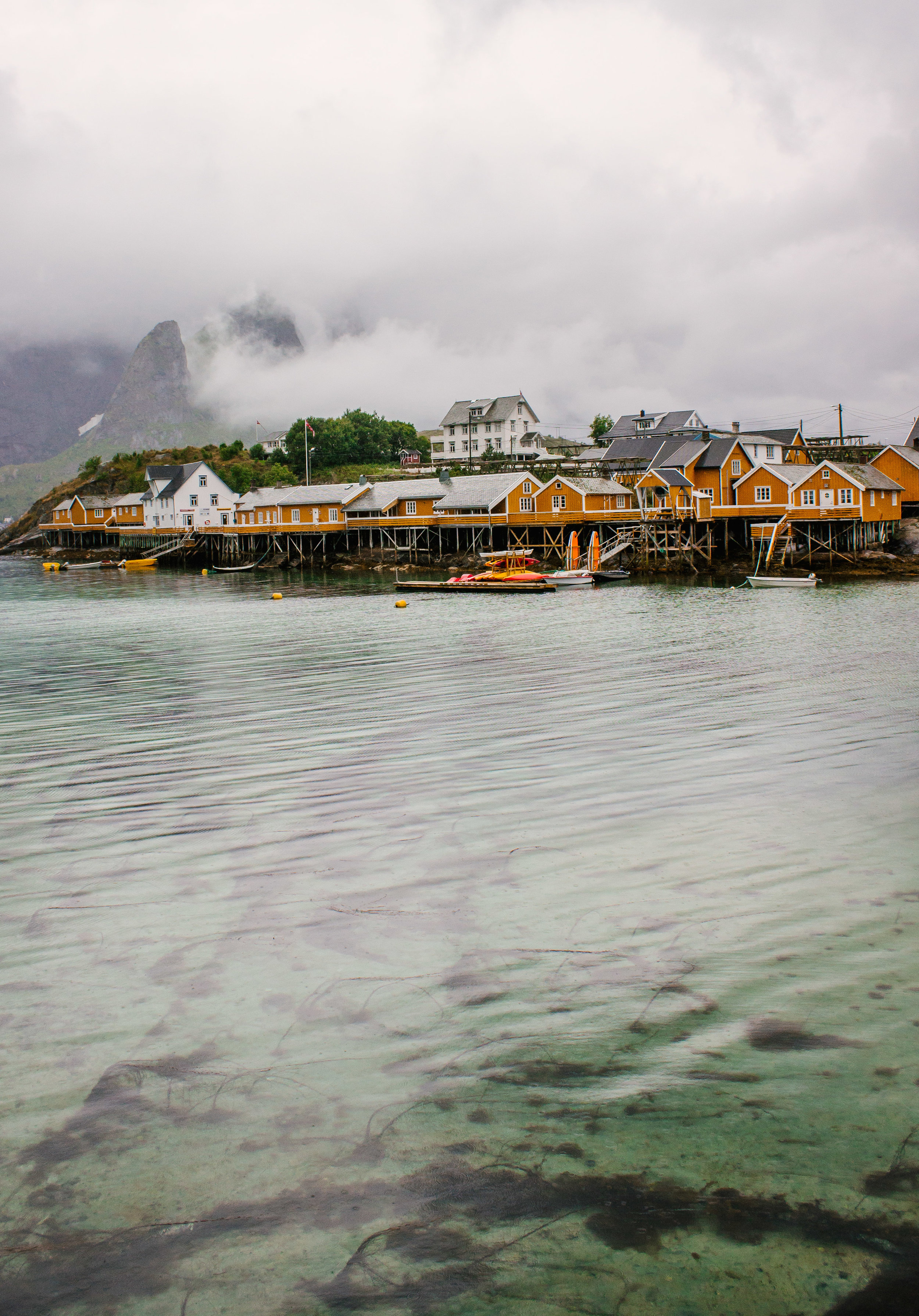

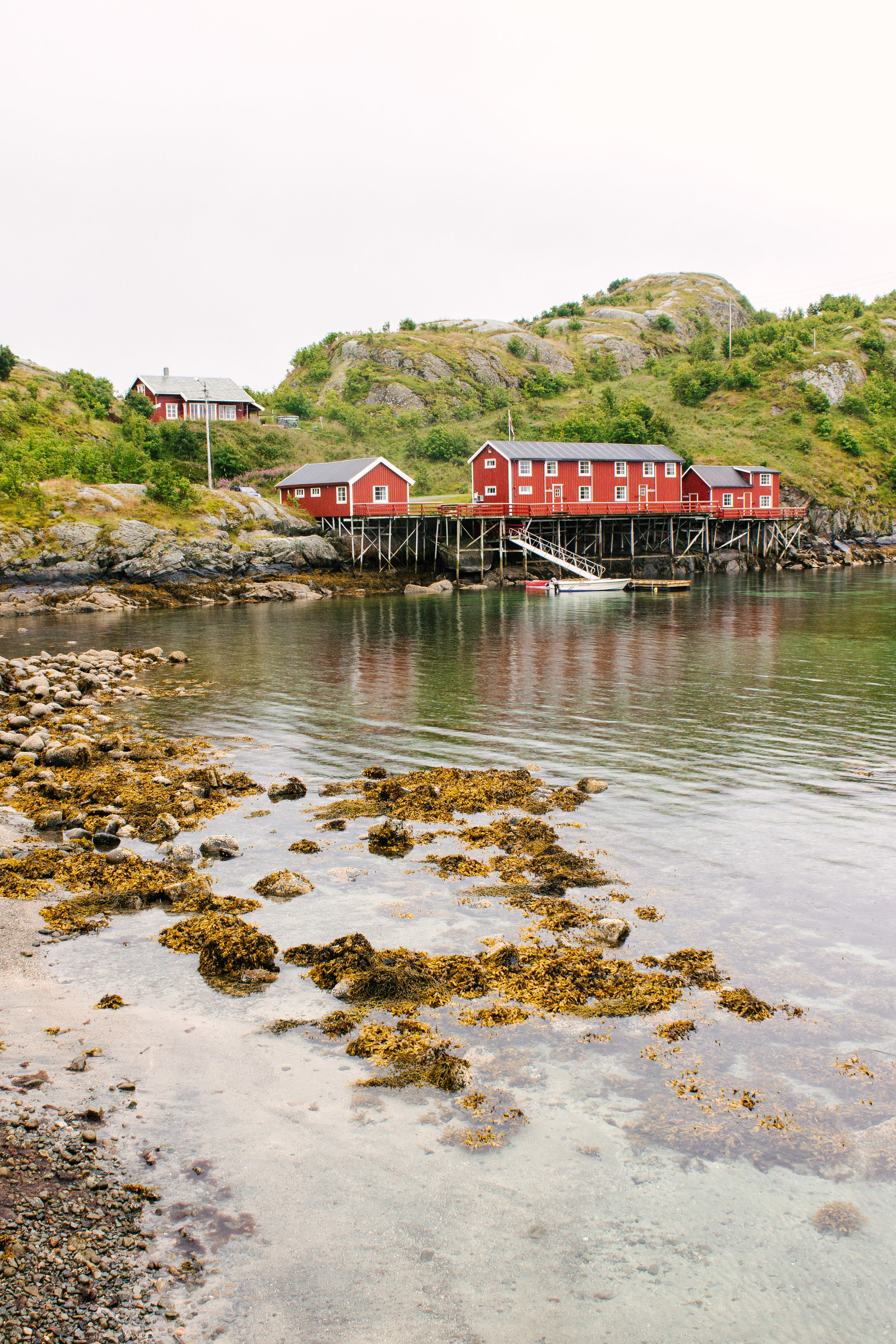
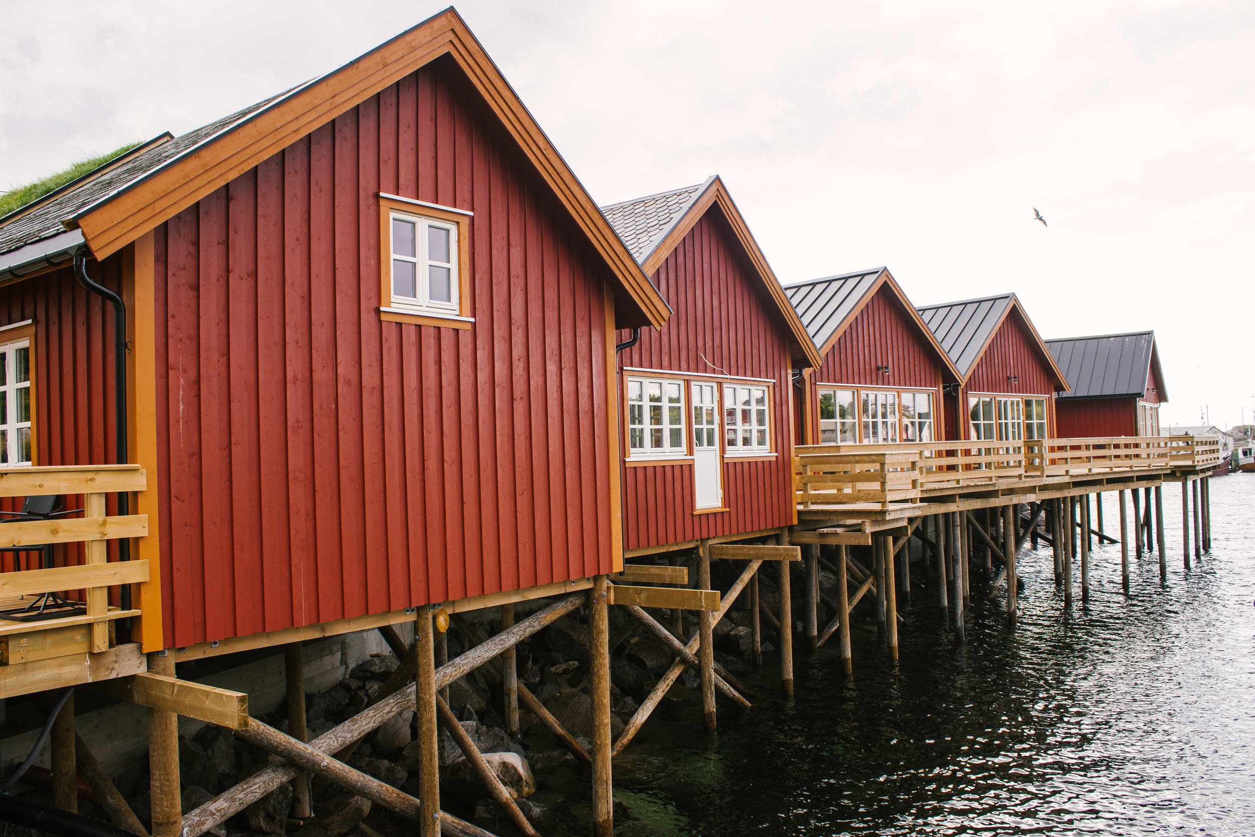
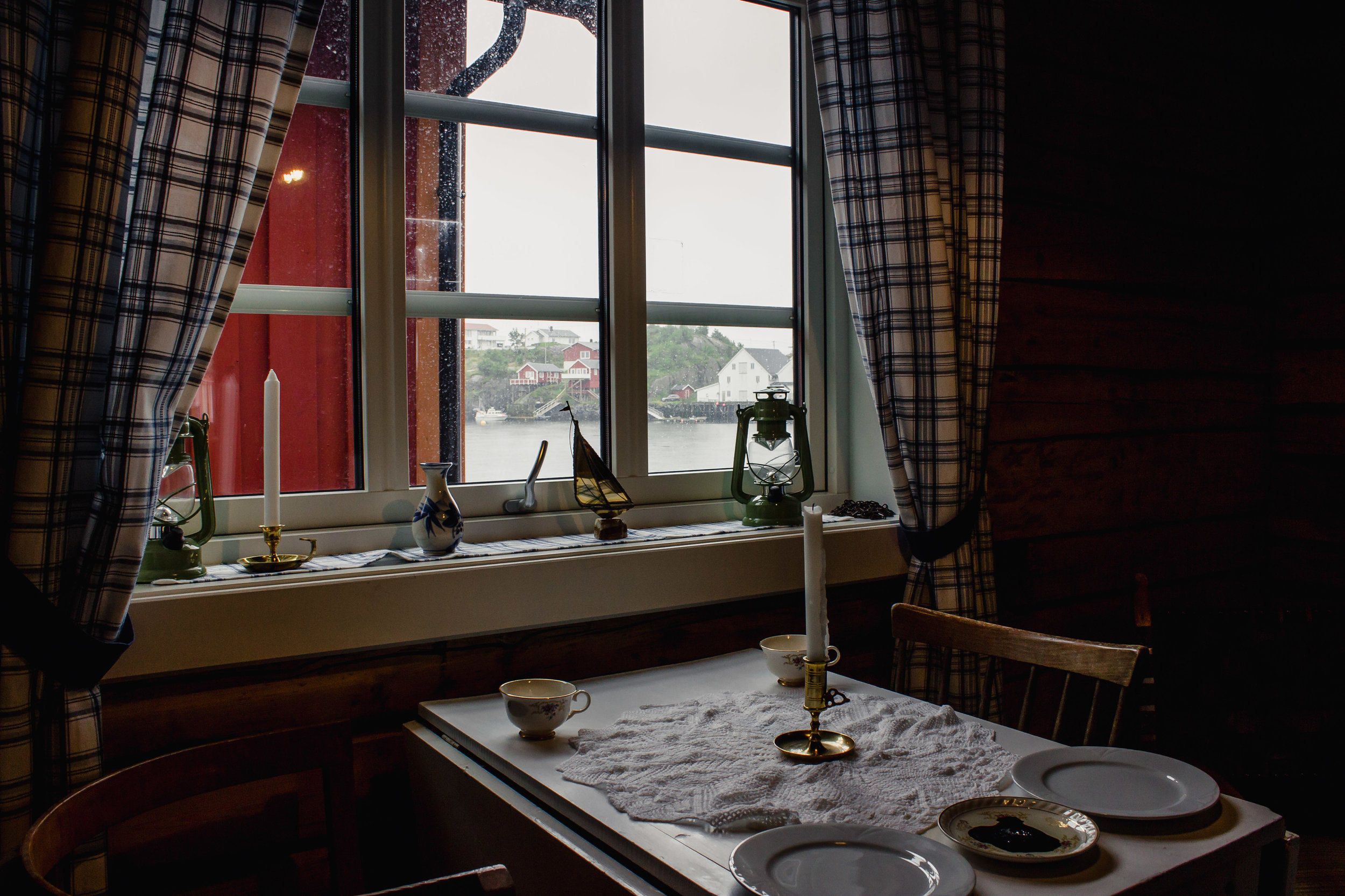
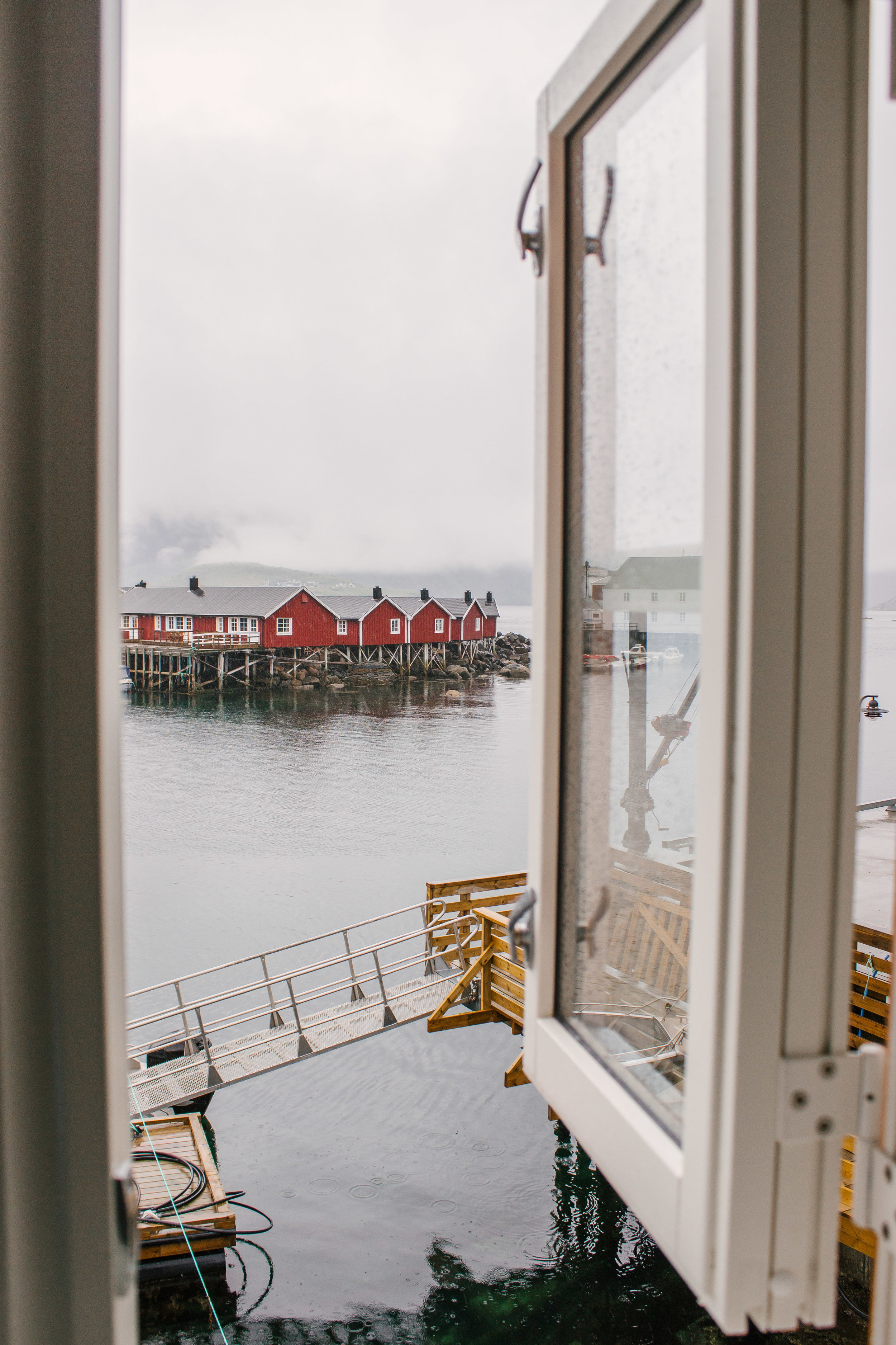
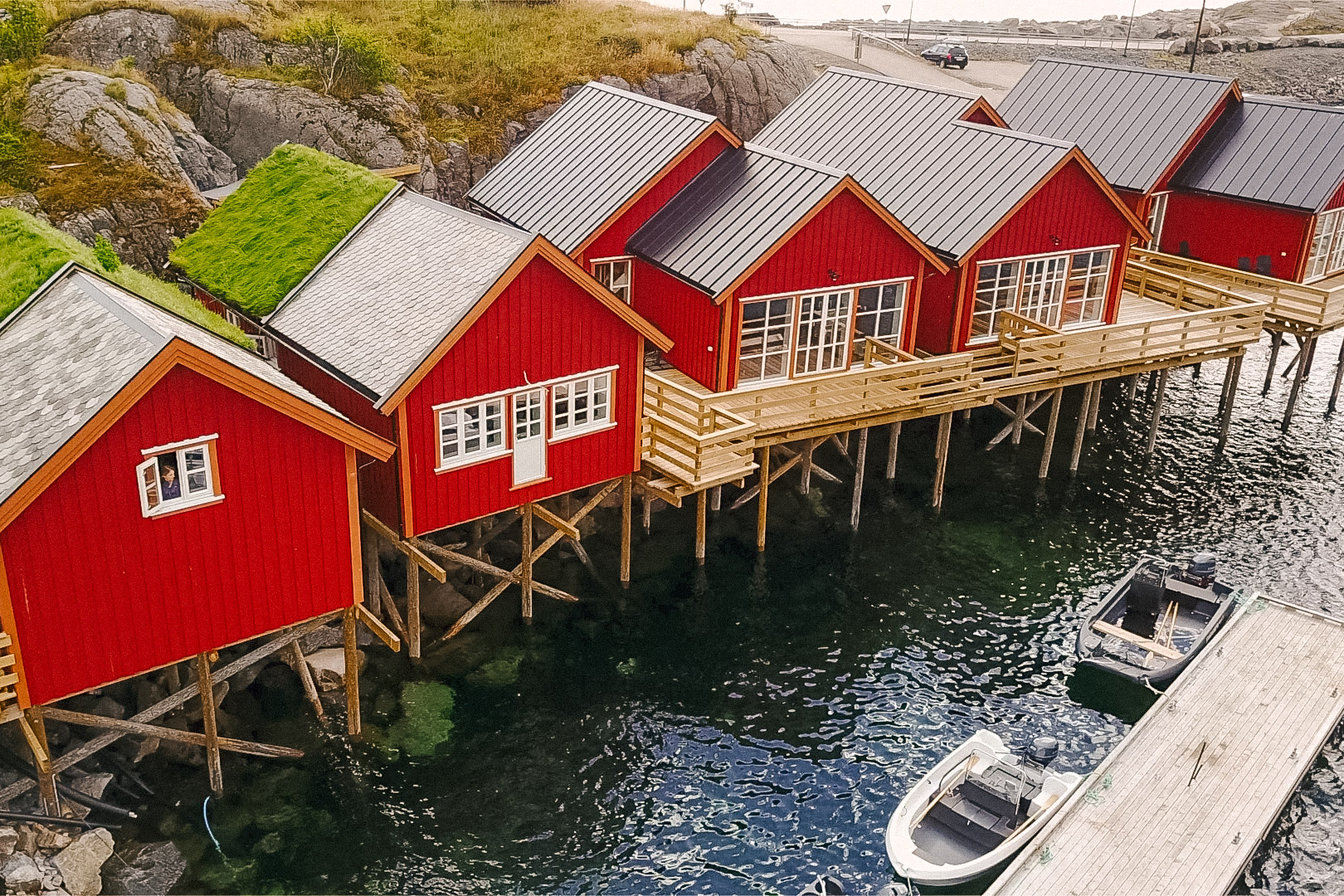
Stay in a Rorbu
Rorbuer are brightly colored, seaside, wooden huts where fishermen used to stay. The majority of the rorbuer have been converted into accommodations for travelers – and staying in one of these huts was certainly on my bucketlist! However our original plans only accounted for camping sites because rorbuer can be pretty pricey. But when a large storm hit Lofoten, bringing half a day’s worth of rain, we thankfully were able to find a last minute affordable deal at Reinefjorden Sjøhus. Passing by the afternoon in a cozy cabin, rich with history, with my favorite person was a wonderful change of plans.
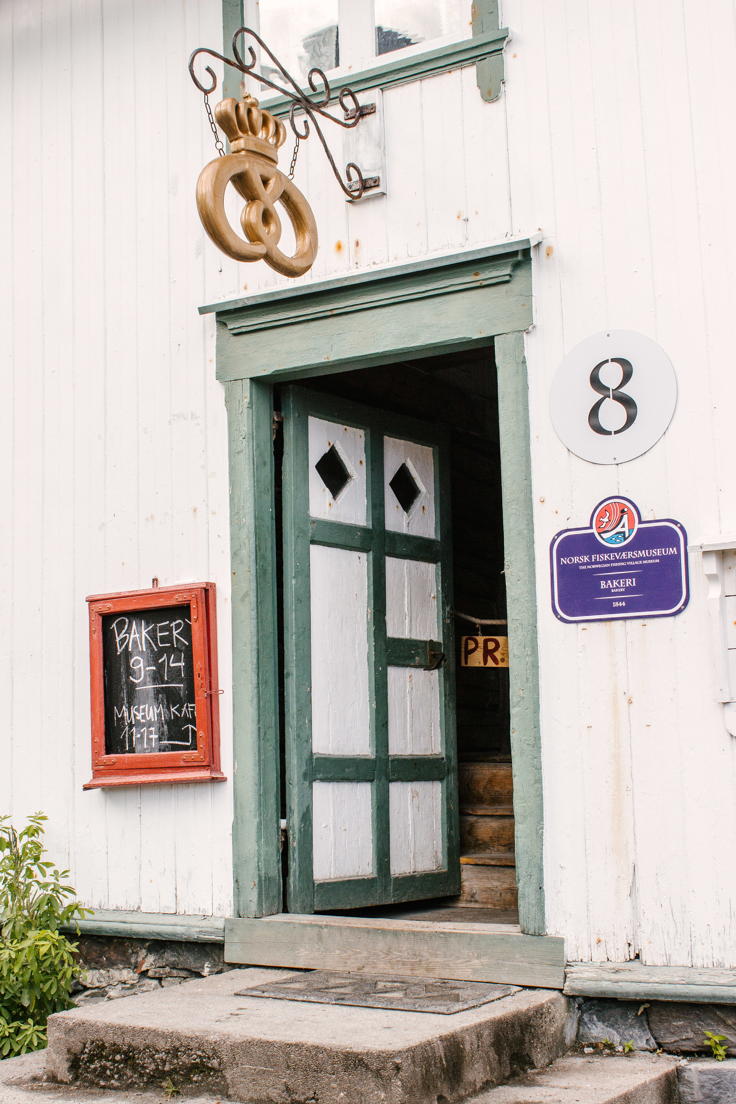
Å
The small town of Å marks the western end of the E10 road. There is a small bakery here that was originally built over 170 years ago. (Like WHAT!) In the summer, the bakery is a “demonstration bakery”, showing customers how their beloved baked goodies were made back in the old days. We bought some cinnamon rolls, which came highly recommended by multiple people we had met during our time in Lofoten. Their cinnamon rolls took me by surprise because unlike American cinnamon rolls, drenched in sweet icing and glued together by brown sugary-buttery goodness, these rolls could be described more as a cinnamon infused bread twist. They were delicious nonetheless!

I hope this blog post has inspired you to add Lofoten to your bucket list of travel destinations!